|
BICYCLE
ILLINOIS
Carbondale to Centralia
Overall
Route Description
The second day of
riding from Carbondale
to
Centralia is still
a bit hilly
at first, but it quickly transitions
to flatter ground. Heading out
of Carbondale you'll start
to see more farms dotted among
forested areas, and passing through
Royalton and Sesser you'll
see several coal mines and ride
through several town that have
seen better days. Finally you'll
arrive in Centralia, an old coal
mining town itself, and home
to the "winningest" high
school boys basketball team in
the United States.
Century
Option
The
century option from Carbondale
to Centralia will be a century
loop that both
starts and ends at the Centralia
main lodging site. A rest stop
will
be set
up at the main lodging site to
replenish yourself before
riding the century option.
Satellite Imagery Overlay
- Click
Here for all
rest stops overlaid on satellite
imagery.
RIDE
ITINERARY
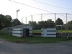 |
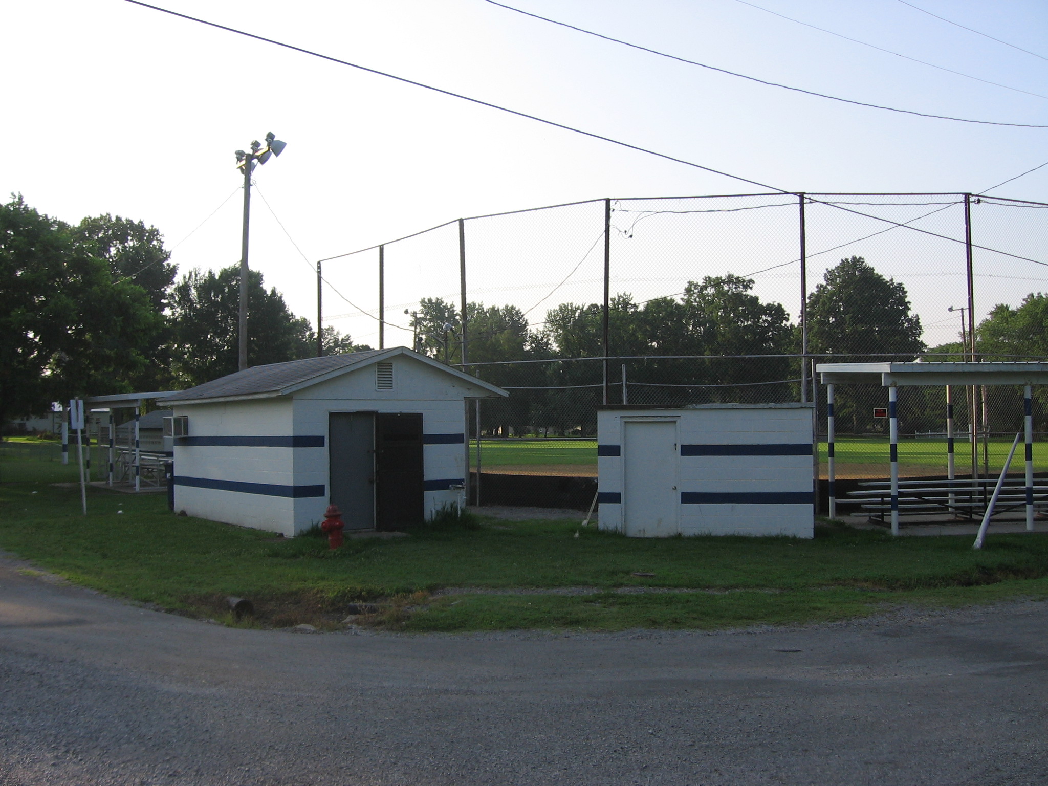
Rest Stop 1
Royalton Curtis Ball Field
Royalton, IL
16.3 miles from the main
lodging site
16.0 miles from the supported hotel
Rest Stop 1 will close at
8:15 am. |
 |
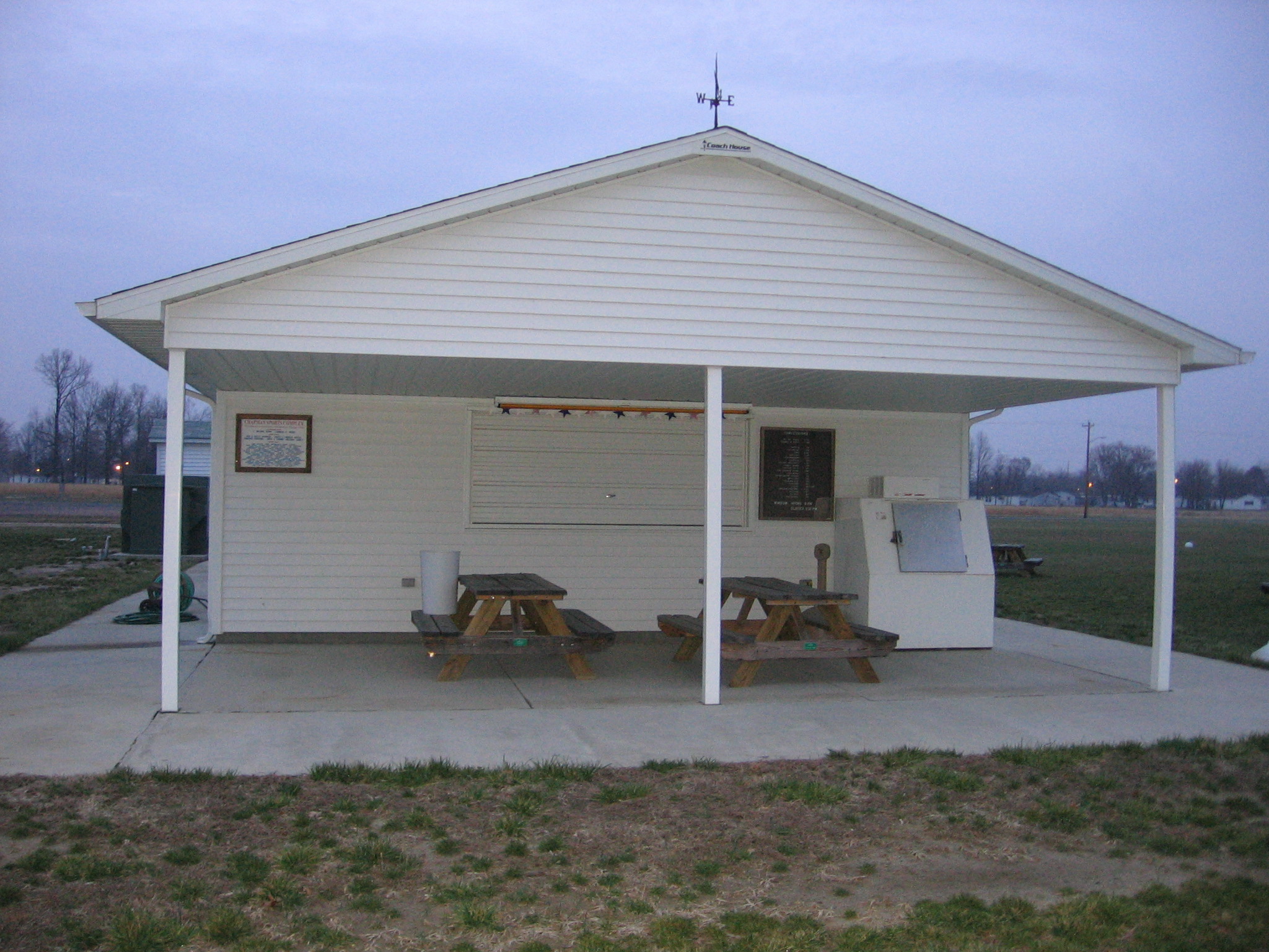
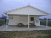
Rest Stop 2
Miners Memorial
Park
Sesser, IL
18.4 miles from rest stop
1
Rest Stop 2 will close at
10:15 am. |
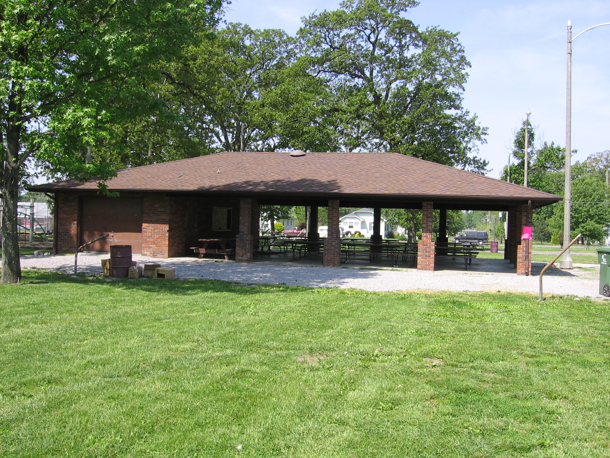
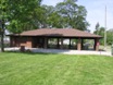
 |
Rest Stop 3
Chapman Sports Complex
Woodlawn, IL
17.1 miles from rest stop
2
Rest Stop 3 will close at
12:15 pm. |
 |
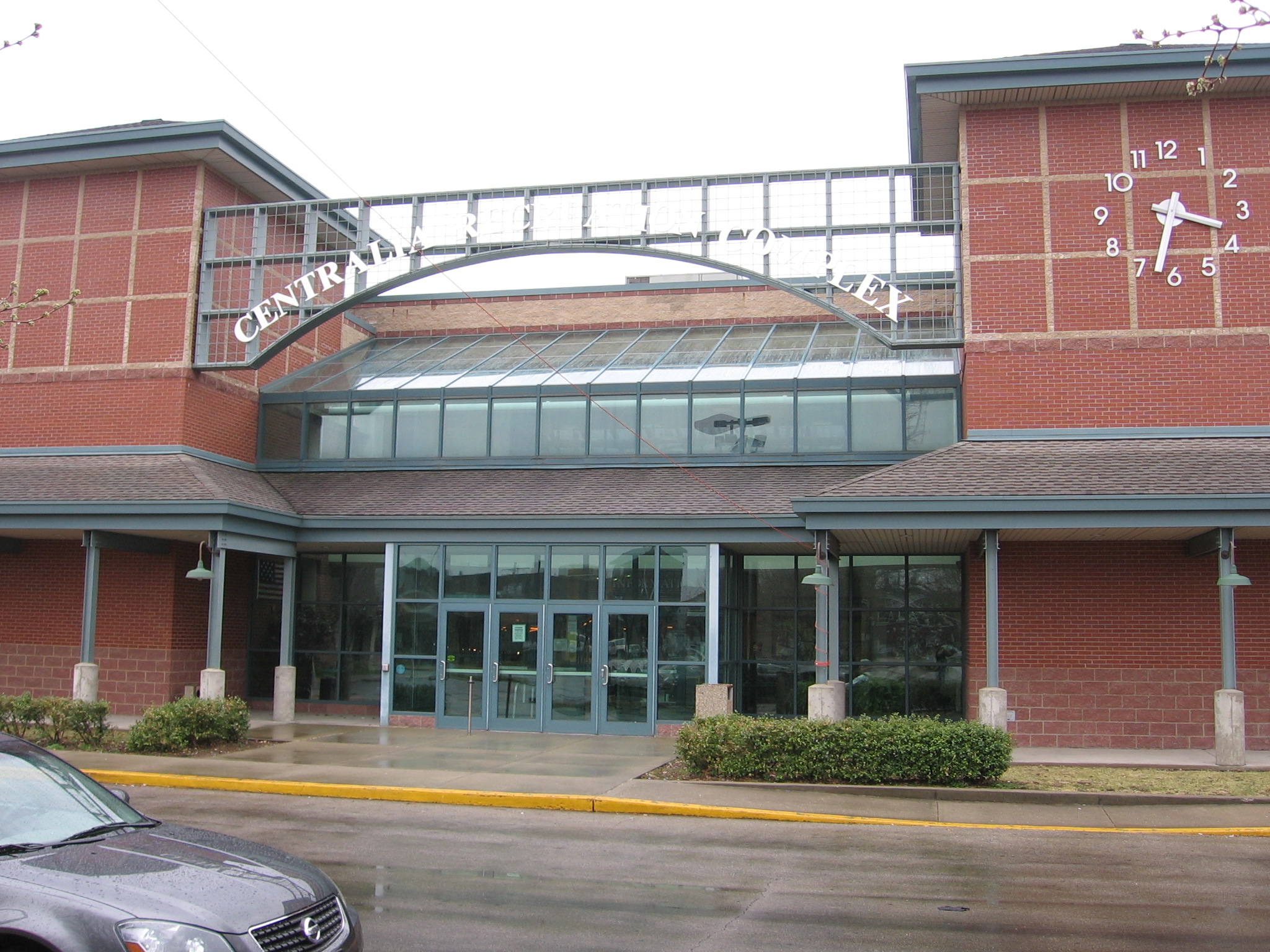
End - Centralia
Main Lodging Site
Centralia
Recreation Complex
115 East Second Street
Centralia, IL 62801
(618) 532-3214
22.4 miles from rest stop
3 |
Route
Profile Data
Each
Ride Segment
| |
Carbondale
to Royalton |
Royalton
to Sesser |
Sesser
to
Woodlawn |
Woodlawn
to
Centralia
Main
Lodging |
Centralia
Century
Loop
Option |
Centralia
Main
Lodging
to
Centralia
Hotel |
From
Carbondale
Hotel
|
From
Carbondale
Main Lodging |
| Distance (mi) |
16.0 |
16.3 |
18.4 |
17.1 |
22.4 |
28.0 |
1.7 |
| Elevation Profile |
|
|
|
|
|
|
|
Starting
Elevation
(ft) |
387 |
431 |
433 |
475 |
496 |
486 |
486 |
Ending
Elevation
(ft) |
433 |
433 |
475 |
496 |
486 |
486 |
500 |
Highest
Elevation
(ft) |
464 |
514 |
532 |
540 |
620 |
608 |
504 |
Lowest
Elevation
(ft) |
325 |
389 |
417 |
449 |
475 |
447 |
451 |
Gross
Climb
(ft) |
776 |
765 |
784 |
510 |
1013 |
1263 |
100 |
Gross Climb
Profile |
|
|
|
|
|
|
|
| Net Climb (ft) |
46 |
2 |
42 |
21 |
-10 |
0 |
14 |
| Gross Grade |
0.9 |
0.9 |
0.8 |
0.6 |
0.9 |
0.9 |
1.1 |
| Net Grade |
0.1 |
0.0 |
0.0 |
0.0 |
0.0 |
0.0 |
0.2 |
Ride
Segment Summary
| Unique Ride Segments |
7 |
| Total Possible Routes |
8 |
| Total Rest Stops |
5 |
| On Road Rest Stops |
3 |
| Rest Stops Ridden To |
4 |
Every
Potential Route
| Departure Location |
Main
Lodging |
Main
Lodging |
Main
Lodging |
Main
Lodging |
Supported
Hotel |
Supported
Hotel |
Supported
Hotel |
Supported
Hotel |
| Daily Option(s) |
N/A |
N/A |
N/A |
N/A |
N/A |
N/A |
N/A |
N/A |
| Arrival
Location |
Main
Lodging |
Main
Lodging |
Supported
Hotel |
Supported
Hotel |
Main
Lodging |
Main
Lodging |
Supported
Hotel |
Supported
Hotel |
| Century Option |
No |
Yes |
No |
Yes |
No |
Yes |
No |
Yes |
| Rest Stops |
4 |
5 |
4 |
5 |
4 |
5 |
4 |
5 |
| Total Distance (mi) |
74.2 |
102.2 |
75.9 |
103.9 |
73.9 |
101.9 |
75.6 |
103.6 |
| Elevation Profile |
|
|
|
|
|
|
|
|
Starting
Elevation
(ft) |
431 |
431 |
431 |
431 |
387 |
387 |
387 |
387 |
Ending
Elevation
(ft) |
486 |
486 |
500 |
500 |
486 |
486 |
500 |
500 |
Highest
Elevation
(ft) |
620 |
620 |
620 |
620 |
620 |
620 |
620 |
620 |
Lowest
Elevation
(ft) |
389 |
389 |
389 |
389 |
325 |
325 |
325 |
325 |
| Gross Climb (ft) |
3072 |
4335 |
3172 |
4435 |
3083 |
4346 |
3183 |
4446 |
Gross Climb
Profile |
|
|
|
|
|
|
|
|
| Net Climb (ft) |
55 |
55 |
69 |
69 |
99 |
99 |
113 |
113 |
Longest Ride
Segment
Distance (mi) |
22.4 |
28.0 |
22.4 |
28.0 |
22.4 |
28.0 |
22.4 |
28.0 |
Shortest Ride
Segment
Distance (mi) |
16.3 |
16.3 |
16.3 |
16.3 |
16.0 |
16.0 |
16.0 |
16.0 |
Average Distance
Between Rest
Stops
(mi) |
18.6 |
17.0 |
18.6 |
17.0 |
18.5 |
17.0 |
18.5 |
17.0 |
Longest Ride
Segment
Gross
Climb (ft) |
1013 |
1263 |
1013 |
1263 |
1013 |
1263 |
1013 |
1263 |
Shortest Ride
Segment
Gross
Climb (ft) |
510 |
510 |
510 |
510 |
510 |
510 |
510 |
510 |
Average Gross
Climb
Between
Rest Stops
(ft) |
768 |
723 |
768 |
723 |
771 |
724 |
771 |
724 |
| Gross Grade |
0.8 |
0.8 |
0.8 |
0.8 |
0.8 |
0.8 |
0.8 |
0.8 |
| Net Grade |
0.0 |
0.0 |
0.0 |
0.0 |
0.0 |
0.0 |
0.0 |
0.0 |
|